Scafell Pike

The summit of Scafell Pike, viewed from Ill Crag
Location: NY 215 072
Getting there: Most common route is from Wasdale, but alternative approaches from Eskdale, Langdale and Borrowdale
Height (at Trig Point on summit): 978m
Prominence: 912m
Map: OS Explorer OL6 (though other maps may be required, depending on route
The highest point in England, this popular destination in the Lake District has some incredible routes, crags and views, especially once you venture away from the well-trodden National Three Peaks path from Wasdale.
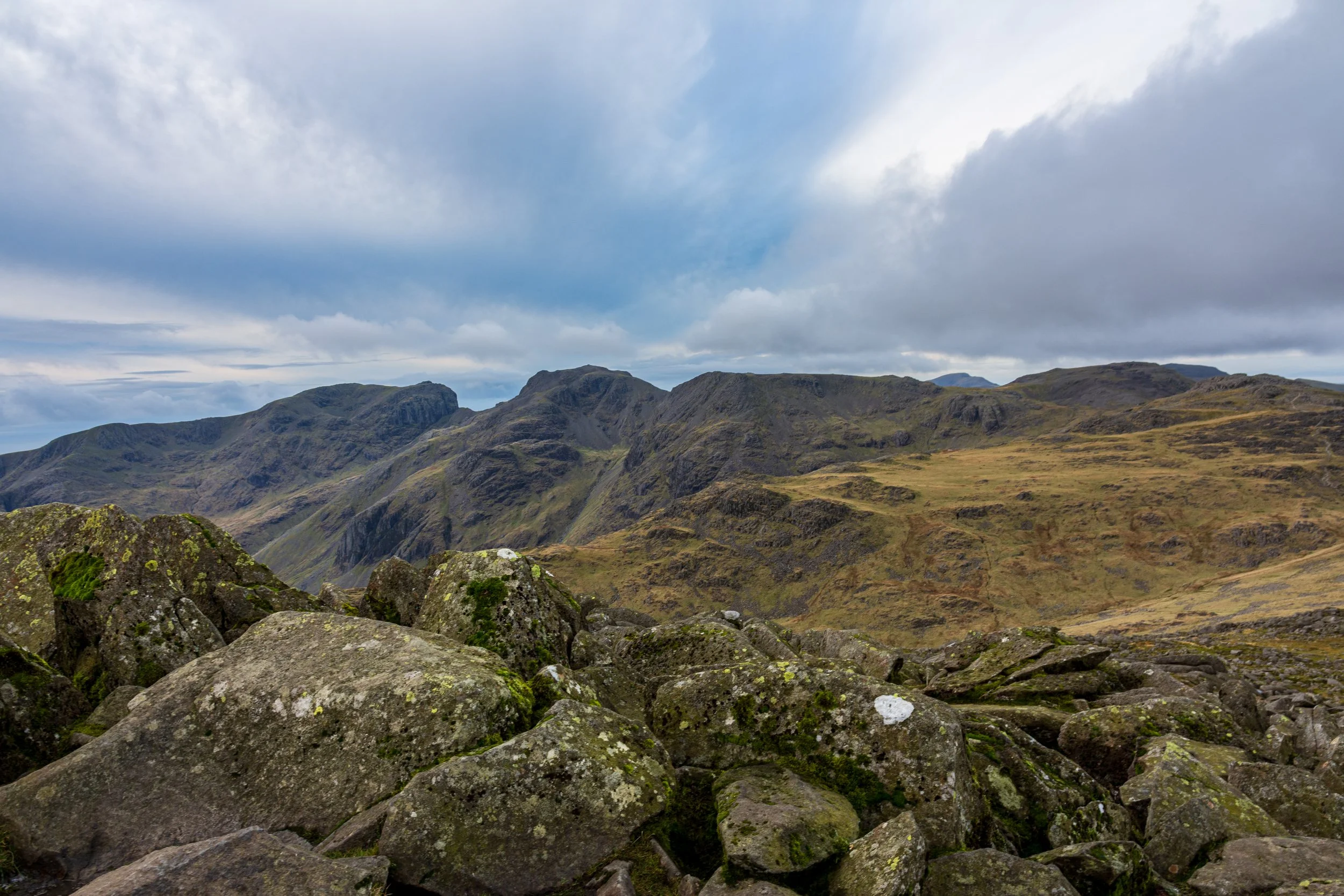
Scafell to the left, Scafell Pike in the centre, followed by Broad Crag, Ill Crag and Great End, viewed from Esk Pike
Scafell Pike forms part of a ring of mountains, crags and peaks that were once part of an extinct volcano. Indeed, there is some dispute as to how much of the massif is actualyl considered to be Scafell Pike, and which peaks are mountains in their own right, with some adamant that the neighbouring sections of Broad Crag and Ill Crag are actually part of Scafell Pike.
Some of this confusion comes from the name itself. Scafell Pike neighbours another mountain, Scafell, and as the name suggests, Scafell is historically considered to be the higher peak - indeed from some angles, Scafell will often appear taller than all of its neighbours. The ‘Pike’ part of the name derives from the fact that Scafell Pike, Ill Crag and Broad Crag were considered to be the ‘pikes’ of Scafell, and Scafell Pike was not really considered as an important, seperate peak until it was realised that it was the highest point in England in the 1800s.
The name ‘Scafell’ itself is derived from Old Norse, ‘skalli fjall’, believed to mean the ‘fell with the bald summit’, although this is far from certain.

Scafell towering to the left, and Scafell Pike to the right, seperated by the Mickledore Col, part of the route up from Wasdale
Scafell Pike forms part of the national Three Peaks, along with Snowdon and Ben Nevis. The National Three Peaks challenge takes on all three mountains in 24 hours (including driving time), and due to its location, is always the second of the three peaks. The rotue taken for the challenge starts and ends in Wasdale - this is longer to reach by car, but is the shortest route from the road to reach the summit.
The Wasdale route is with its well-defined paths and easy-to-follow route is also popular with many tackling the peak for the first time, keen to bag the highest summit in England, and as such the summit is usually quite busy with people, often taking to the mountain slightly under-equipped for a full-day out in the mountains.
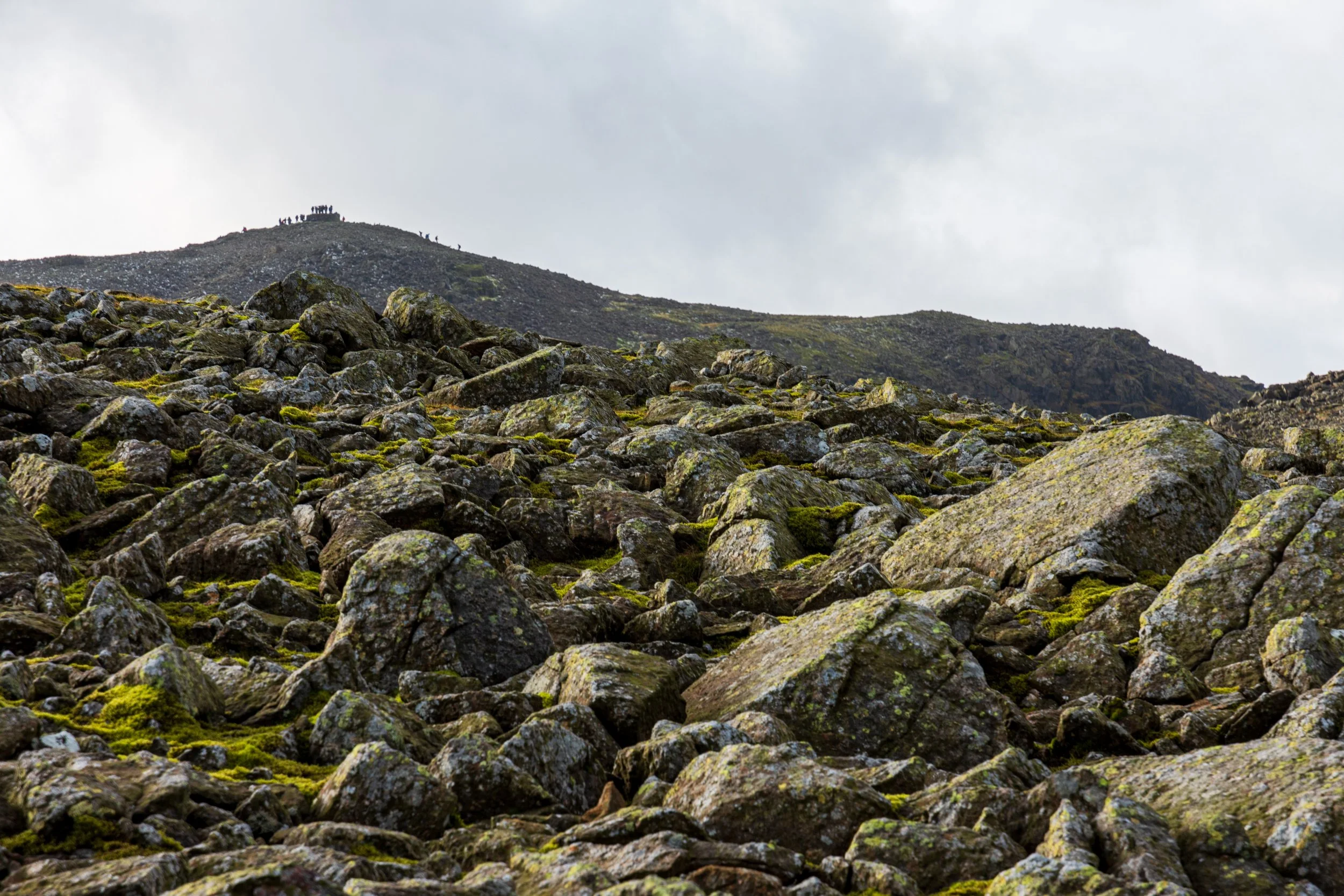
The summit of Scafell Pike can get pretty busy
However a more adventurous route from Wasdale could take in neighbouring Lingmell, or tackle Great Gable if you are up for some scrambling.
My favoruite route is to start in Great Langdale, which is easily accessible from the central lakes - this is a route that starts in a lovely, verdant valley, and although is a long day out, offers the opportunity to tackle Broad Crag, Ill Crag and Great End, before also climbing Esk Pike and Bowfell on the way back.
For a quieter, but much longer walk in, there is the route from Eskdale, which either ascends up Little Narrowcove, or an optional Grade 1 scramble up Ill Crag. This also opens up the possibility of a return route via Scafell.
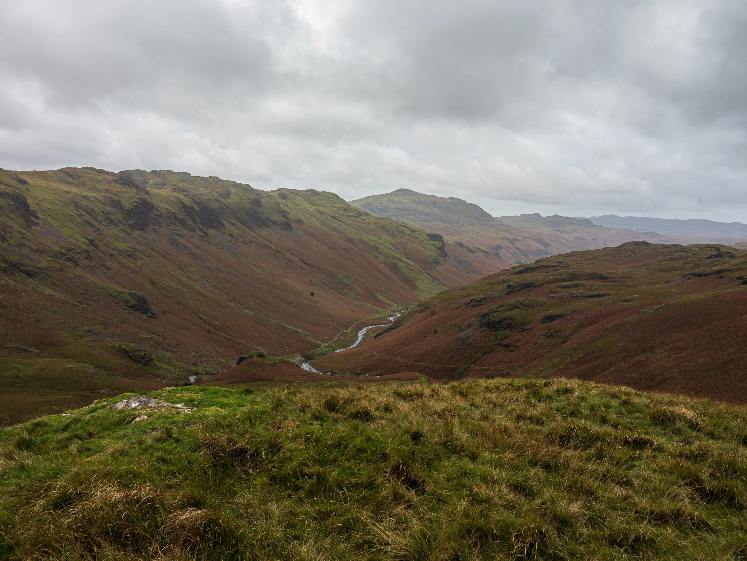
A long walk in to Scafell Pike, from Eskdale
Finally, for anyone based near Keswick and Derwentwater, there is an approach from Seathwaite - either following either Styhead Gill or Grains Gill on the way up, and the other gill on the return - alternatively you can also take in the peaks on either side of the gills - head up Green/Great Gable and/or Allen Crags and Glaramara. This approach usually involves the ‘Corridor Route’, which is one of the more interesting ascents up the mountain, and involves a couple of brief moments of exposure and a small down climb. Take care with the downclimb as I’ve sometimes seen people stray into more dangerous terrain to avoid it!

Looking back at the bad step on the Corridor Route up to the summit of Scafell Pike
Scafell Pike is of course something of a popular location for the Mountain Rescue Teams - be under no illusion that this is a serious mountain, which is disorientating in (often) poor visibility, paths that disappear as they cross boulder fields, and serious rocky and exposed terrain if you venture off route. In particualr, Piers Gill is an accident blackspot to be avoided, leading to several callouts and occasional fatalities.
On a clear day, the views on the summit are as exapnsive as you might expect, with most of the prominent Lake District Peaks visible, the Yorkshire Three Peaks, The Cheviot in Northumberland, several peaks in the Scottish Borders and Galloway, and the western Pennines around Manchester (including Pendle Hill and Winter Hill).
It’s even said that the peaks of Snowdonia can be seen, along with Snaefell on the Isle of Man, and Slieve Donard and Slieve Croob in Northern Ireland. That said, each time I’ve been up it has been enveloped in cloud, typically rolling in just before I reach the summit!
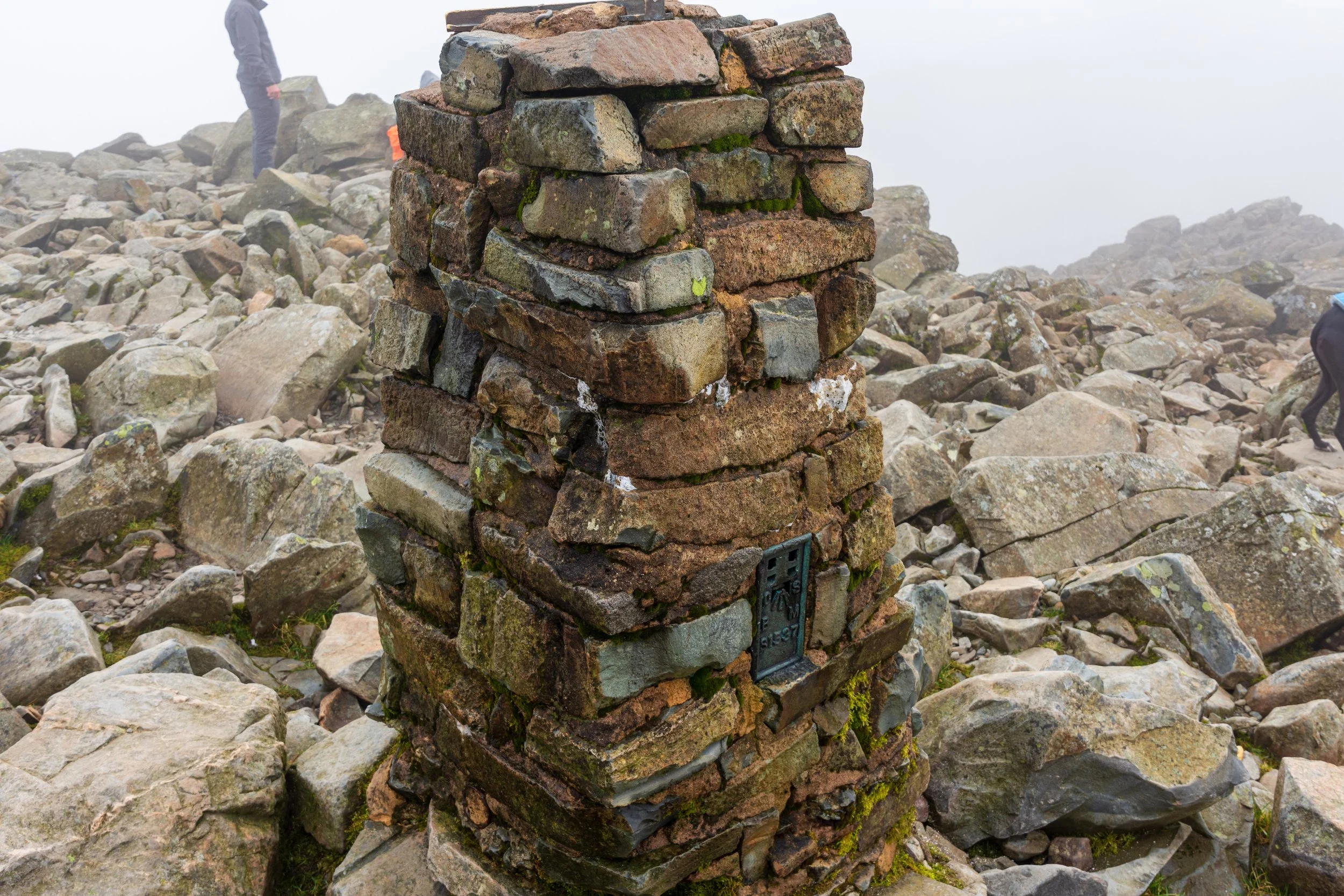
The trig point on the summit of Scafell Pike, with a typical view of the mist.
Indeed, Scafell Pike was historically used as one of the principal triangualtion points by the Board of Ordnace in the 1800s, due to its lines of sight across the Irish Sea to other points in Wales and Northern Island.


